| Map Name | Description | Map |
|---|---|---|
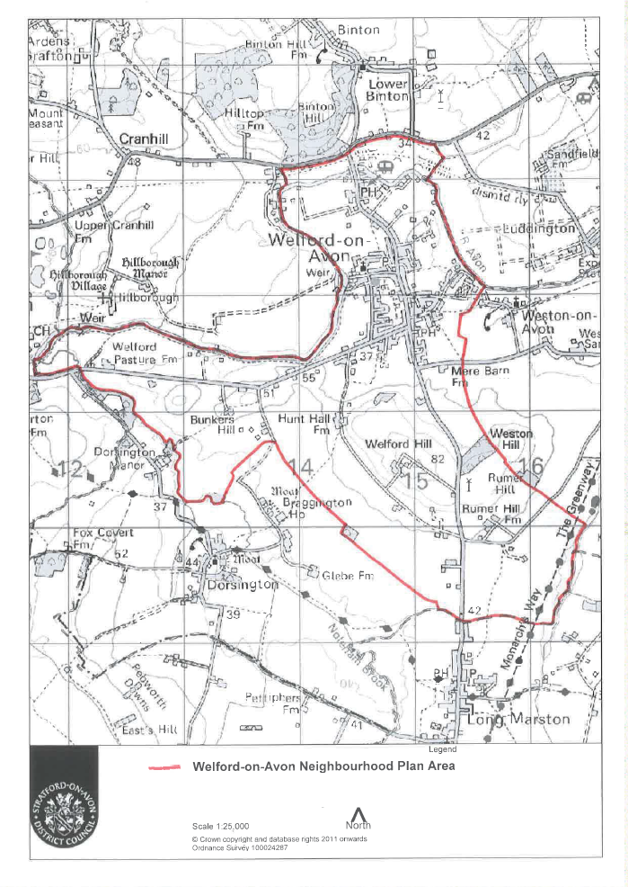
| Neighbourhood Plan Area | This map shows the full scope of Welford on Avon parish including the area of land north of the river Avon up to the B439 road between Bidford and Stratford.
Approved Neighbourhood Plan Area equivalent to the entire parish of Welford-on-Avon |
 |
| Views & Vistas (Policy HE1) | A table has been produced with details of each location including GPS co-ordinates and bearings. A map may be produced in the future | Views and Vistas |
| Local Green Spaces (Policy HE2) | This maps shows the newly defined Local Green Space areas around Welford-on-Avon village which gain substantial protection from development once the plans are made. | 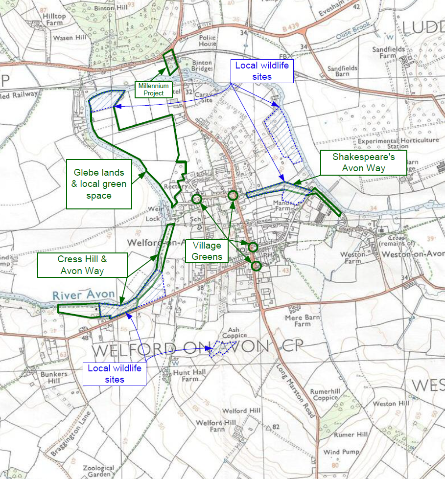 |
| Conservation Area (Policy HE4) | This map produced by Stratford-on-Avon District Council shows Welford on Avon village conservaton area with some explanation in a single page PDF document.
|
 |
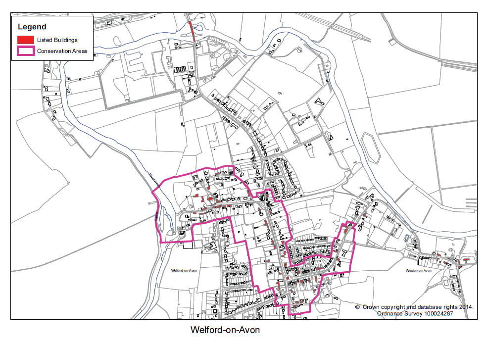
| Conservation Area (Policy HE4) | An alternative representation of the Welford-on-Avon Conservation Area as a simple map.
|
 |
| Agricultural Land Quality (HE5) | This map shows the grade 2 and grade 3A areas of agricultral land. | 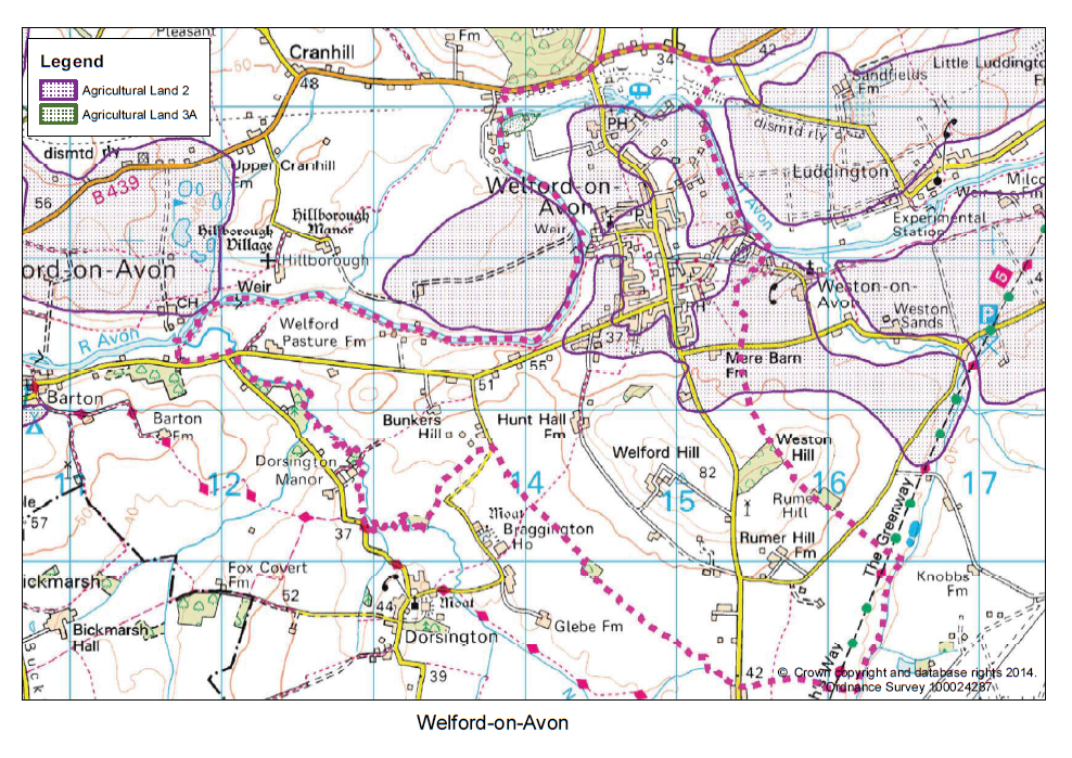 |
| Built-Up Area Boundary as defined in the SHLAA and used for multiple policies (HE5, HE6) | This map was produced by Stratford-on-Avon District Council in 2012.
|
 |
| Land Use - Allotments (HE8) | This map shows multiple different types of land use highlighting the key location of the Allotments | 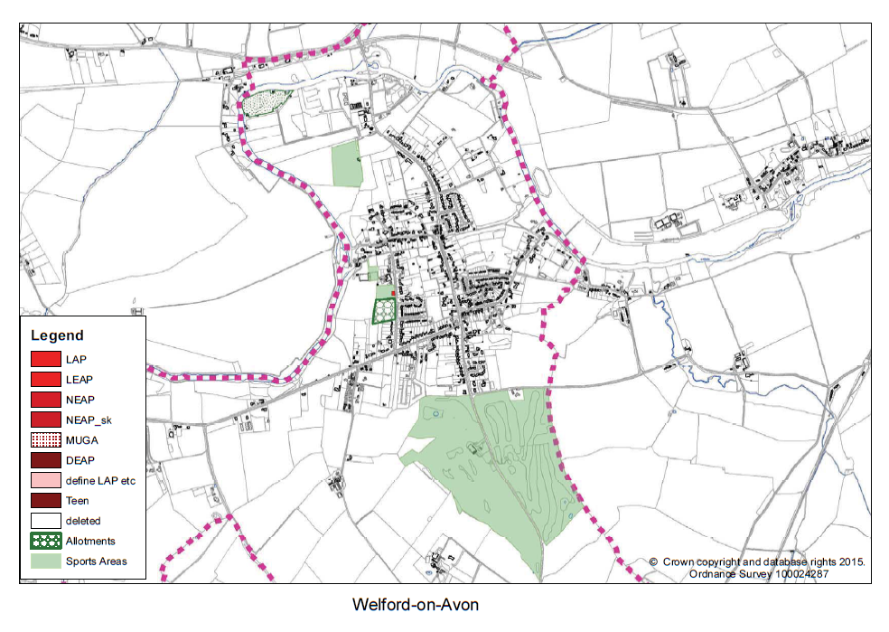 |
| Flood Plain(Policy HE9) | This map was produced from the Environment Agency own website with the simple addition of a legend. | 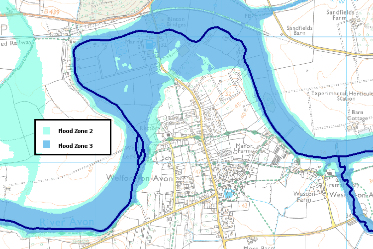 |
| Sewers (Policy INF2) | Severn Trent Sewer Map (10th December 2014) | 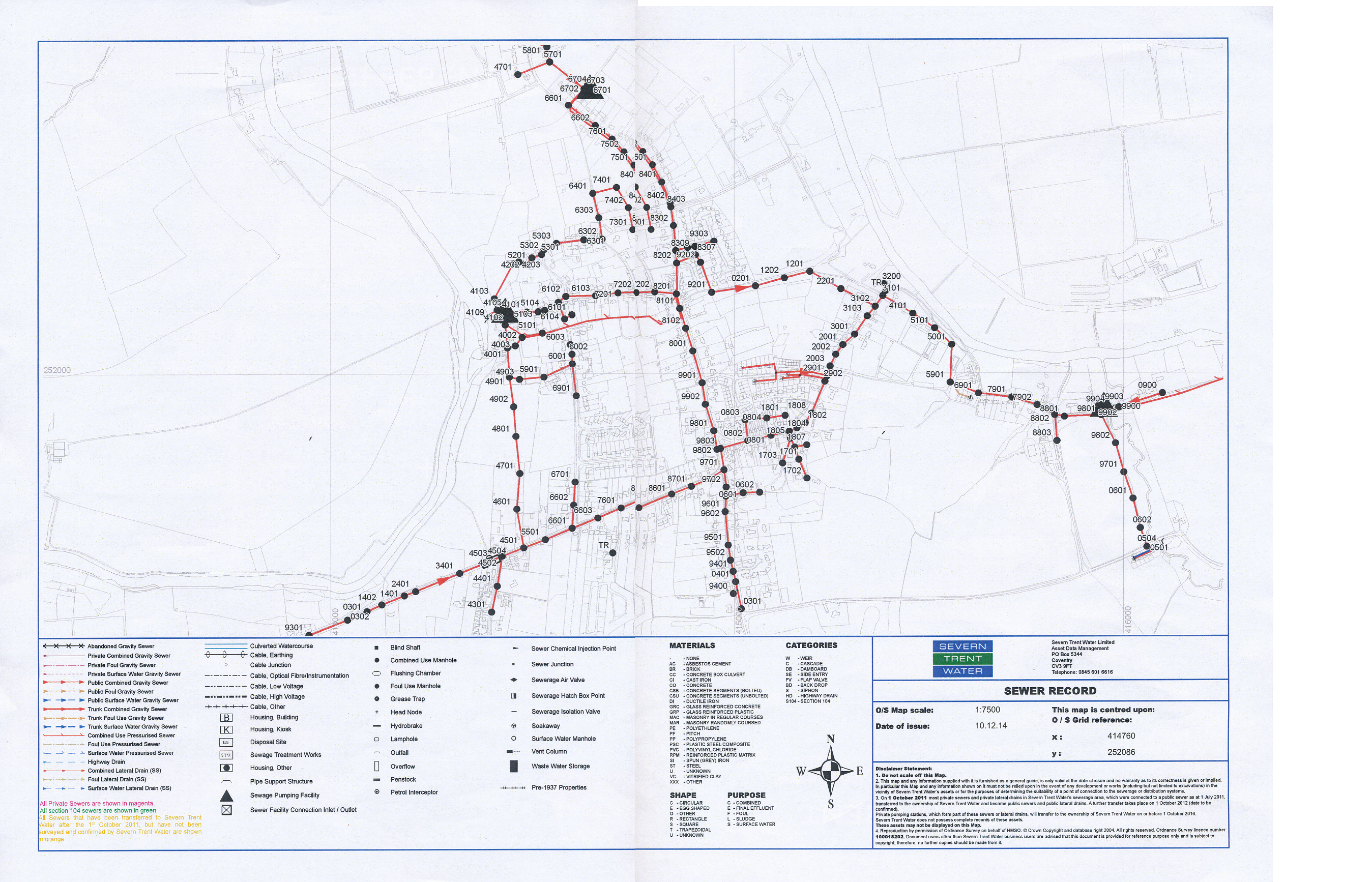 |
| Footpaths & Cycle-ways (Policy HLU4) | a map of all the footpaths is not currently available to include all permissive paths. |